HDSL provides drone-based surveying and mapping services for infrastructure, engineering, construction, and land assessment projects. Our aerial workflows support faster terrain analysis, accurate spatial data capture, and efficient project planning across large and complex environments.
Enquire Now

We create detailed 3D models of sites and structures, enabling better visualisation, planning, and analysis across design, inspection, and monitoring workflows.
We measure stockpiles, excavation, and material volumes with precision, supporting cost estimation, resource planning, and project tracking.
We capture terrain data, including elevation and contours, to support infrastructure planning, drainage design, and land assessment.

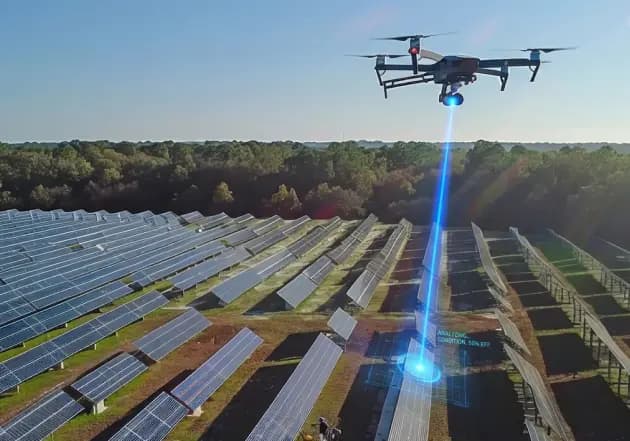
We map large-scale solar installations to support layout validation, performance monitoring, and efficient asset management.

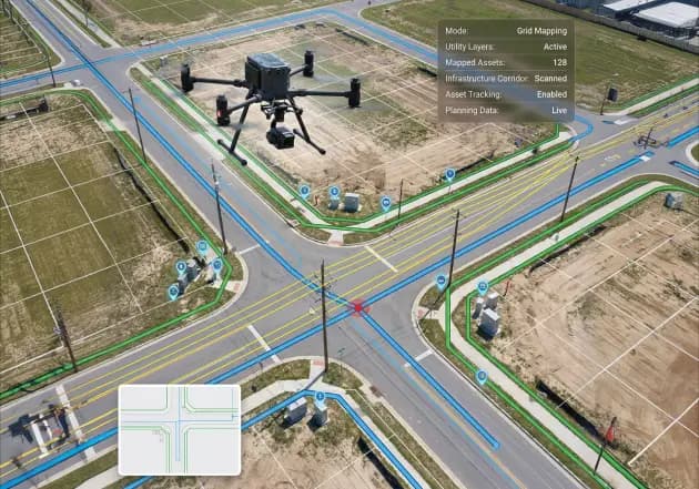
We develop spatial maps of utilities and infrastructure to support planning, monitoring, and long-term asset tracking.
Our drone-based surveying solutions improve speed, visibility, and data reliability, helping teams plan more effectively while reducing time, cost, and operational complexity.
Discover the perfect drone solution for your industry needs.
KNOW MORE


