At HDSL, we provide the InfraScan M400, a rugged enterprise drone platform engineered for high-demand industrial missions. Designed for extended flight endurance and heavy-lift capabilities, it supports multiple sensor and payload configurations, making it ideal for inspections, mapping, public safety, and infrastructure monitoring.
With multi-directional sensing and advanced transmission systems, HDSL ensures reliability and safety during complex operations. This drone's capabilities allow for efficient aerial workflows, especially in remote environments or high-risk infrastructure.


Up to 59 minutes of flight time for long missions

Supports up to 6 kg of sensors and equipment

LiDAR, mmWave radar, and vision sensing enhance safety

O4 Enterprise Enhanced with up to ~40 km range
Multiple payload mounts and accessory integration
Rugged enterprise UAV
IP55
Foldable arms
Dual intelligent batteries
~54 minutes
~25 km
~12 m/s
~21 m/s
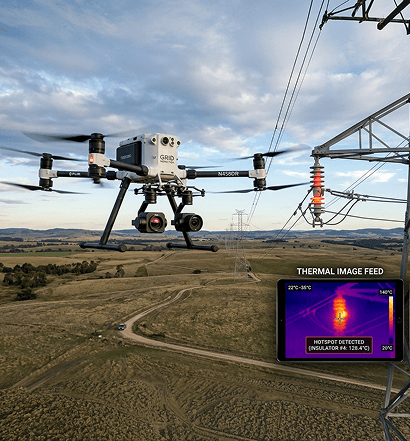
High-precision aerial inspection supports detection of faults, hotspots, and infrastructure risks across transmission networks.

Visual and sensor-based inspection helps identify anomalies and assess operational condition across utility substations.
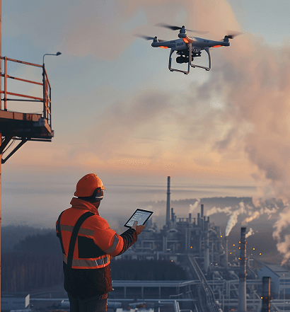
Thermal, visual, and sensor-based inspections support maintenance assessment and operational monitoring across industrial facilities.
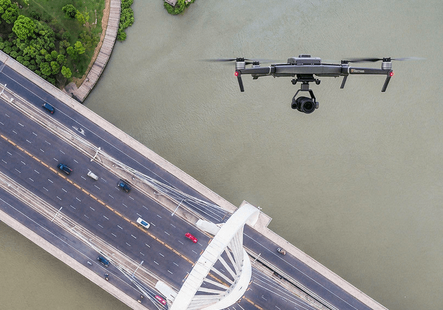
Aerial inspection and mapping support structural assessment across transport and civil infrastructure environments.

Generate detailed digital twins of industrial sites and infrastructure projects for planning, analysis, monitoring, and progress tracking.

