HDSL enables continuous monitoring of infrastructure projects through high-accuracy aerial data capture. From construction progress to structural inspections, our solutions provide clear visibility, timely insights, and reliable reporting, helping stakeholders track performance, identify risks early, and maintain control across complex projects and large-scale developments.
Enquire Now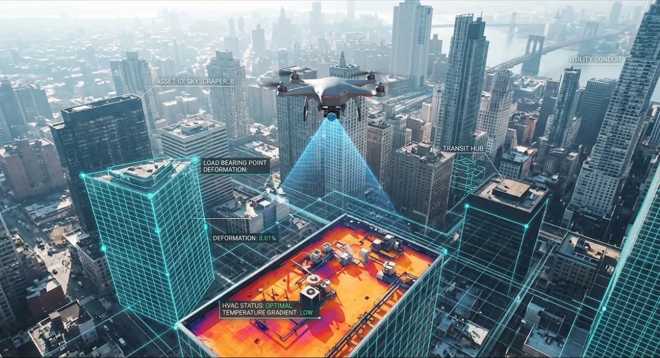
Our cutting-edge drone systems track project progress with regular aerial updates, enabling stakeholders to compare timelines, monitor site activity, and ensure alignment with planned milestones.
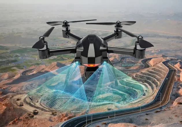
We provide continuous aerial visibility to monitor mining operations, site conditions, and material movement, supporting safety, planning, and operational efficiency.

We provide continuous aerial visibility to monitor mining operations, site conditions, and material movement, supporting safety, planning, and operational efficiency.

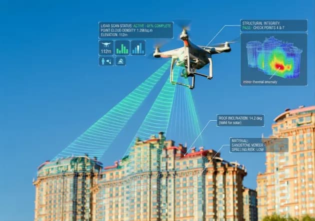
Our drones inspect critical infrastructure for structural integrity, detecting defects, wear, or risks without disrupting operations or requiring manual access.
Drone-based monitoring provides consistent visibility, accurate data, and faster reporting, enabling better project control, early risk detection, and improved decision-making across infrastructure and construction environments.
Discover the perfect drone solution for your industry needs.
KNOW MORE


